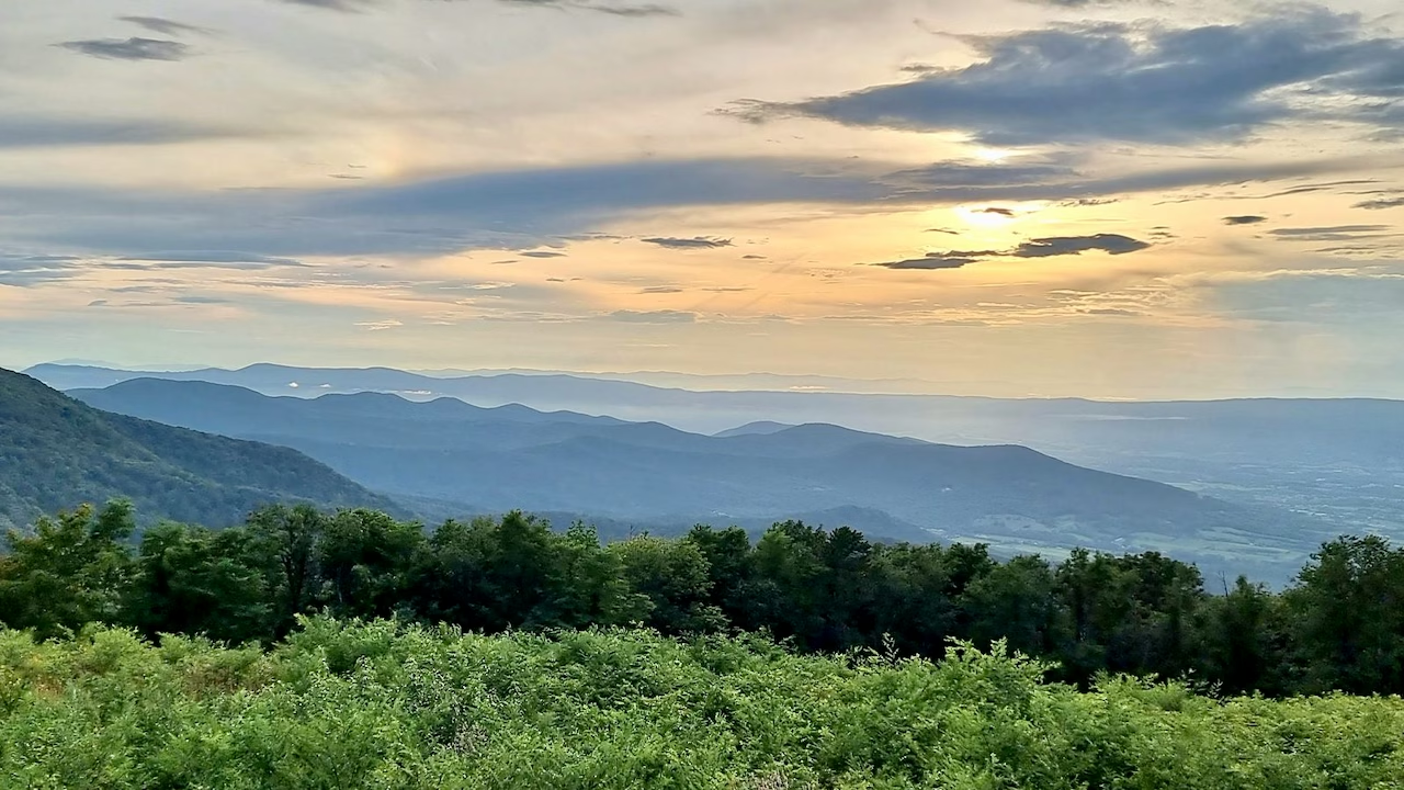
A Shenandoah National Park day trip doesn’t need an early start. I came straight from Luray Caverns, drove in at the North Entrance at Front Royal at 3:51 pm, and by 7 pm I’d covered just under half of Skyline Drive (48 of its 105 miles). On the way I stopped at Dickey Ridge Visitor Center and Signal Knob Overlook, and walked a short stretch of the Appalachian Trail at Elkwallow. Then I passed a deer grazing by the road and watched the evening light from Spitler Knoll Overlook. That was on 30 August 2021, in my uncle’s car, with my America the Beautiful pass.
Here’s that route with the times from my photos, plus the best places to add if you have a full day, what the park costs in 2026 and how to get there, including from Washington, DC. Anything I didn’t see myself is marked as researched.
In short: Skyline Drive runs 105 miles along the crest of the Blue Ridge, and driving it end to end takes about three hours without stops. In 2026, a private vehicle pays $30 for a 7-day pass, the park is cashless, and Shenandoah isn’t one of the parks charging the new $100 nonresident fee. For one day, pick a section: mine ran from the North Entrance to Spitler Knoll Overlook (mile 48.1), about three hours with stops.
This post contains affiliate links. If you book through them, I may earn a small commission at no extra cost to you.
️
Entrance
$30 per car, valid 7 days
Cashless: card, phone or recreation.gov
️
Skyline Drive
105 miles, 35 mph
About 3 hours end to end without stops
Entrances
Front Royal, Thornton Gap, Swift Run Gap, Rockfish Gap
Front Royal is closest to Washington, DC
⏱️
My day trip
Mile 0 to mile 48 in about 3 hours
Two overlooks, a visitor centre, a short walk
Fuel
One gas station in the park
At Big Meadows; fill up before you enter
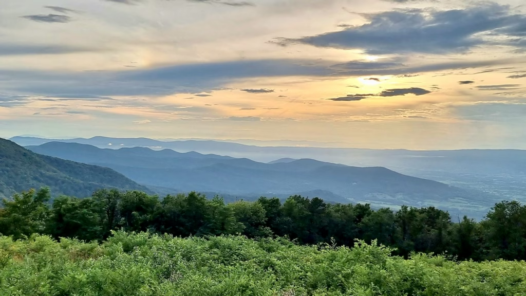 Spitler Knoll Overlook just after 7 pm, the last stop of my afternoon on Skyline Drive.
My Shenandoah Day Trip Route: A Skyline Drive Itinerary
I drove south from the North Entrance, through the park’s North District and into the Central District. The times come from my phone’s photos, and the places from their GPS.
North Entrance, Front Royal (3:51 pm) → Dickey Ridge Visitor Center, mile 4.6 (4:14 pm) → Signal Knob Overlook, mile 5.7 (4:33 pm) → Elkwallow, mile 24: short walk on the Appalachian Trail (5:17 to 5:58 pm) → Thornton Gap, mile 31.5 (6:20 pm) → Spitler Knoll Overlook, mile 48.1 (6:53 to 7:01 pm)
30 August 2021 · about 48 miles of Skyline Drive · just over 3 hours with stops · by car
My route: from Luray Caverns to the North Entrance at Front Royal, then south on Skyline Drive past Dickey Ridge, Signal Knob and Elkwallow to Spitler Knoll Overlook.
Shenandoah Entrance Fees and Passes in 2026
I didn’t pay an entrance fee on the day: I had an America the Beautiful annual pass, which covers entry to all US national parks. Prices and rules have changed since, so here’s what you’ll pay in 2026, from the park’s official fees page.
Shenandoah National Park fees (2026)
Private vehicle
$30, valid 7 days for everyone in the car
Motorcycle
$25, valid 7 days
On foot or by bike
$15 per person aged 16 and over
Shenandoah Annual Pass
$55, US citizens and residents only
America the Beautiful Pass
$80 for US residents, $250 for nonresidents
Payment
Cashless since July 2025: card, phone or recreation.gov
If you’re visiting from abroad, the good news is that Shenandoah isn’t one of the 11 parks, such as Grand Canyon and Yellowstone, that now charge non-US residents an extra $100 per person. So for a single day here, the $30 car pass is all you need.
The park recommends buying a digital pass online in advance, which saves waiting at the entrance station. The one extra ticket to know about is for Old Rag: from 1 March to 30 November, hikers need a $2 Old Rag day-use ticket, bought online in advance, on top of the entrance pass. You don’t need it for Skyline Drive or the overlooks.
Just Shenandoah
- $30 per car for 7 days
- Buy at the entrance by card or on recreation.gov
- No nonresident fee here
Several national parks
- America the Beautiful annual pass
- $80 for US residents, $250 for nonresidents
- The $250 pass also covers the $100 nonresident fee at the 11 busiest parks
My 36-day trip also took in Glacier, Grand Teton, Grand Canyon and Rocky Mountain, which is where an annual pass makes sense. For Shenandoah alone, the car pass is cheaper.
My Shenandoah Day Trip, Stop by Stop
The North Entrance at Front Royal
I reached the North Entrance at 3:51 pm, about 45 minutes after leaving Luray Caverns. This is mile 0 of Skyline Drive. From here the road climbs along Dickey Ridge, and the mileposts by the roadside count up as you head south, which makes it easy to match your position to a park map.
 Mile 0. The North Entrance sign at Front Royal, at 3:51 pm.
The road itself has a story. Work on Skyline Drive began in 1931, before the park was established, using drought relief money that gave jobs to local farmers. From 1933 it continued as a work relief project during the Great Depression of the 1930s, and young men of the Civilian Conservation Corps built the stone walls and landscaped the overlooks (roadside viewpoints) you stop at today.
Dickey Ridge Visitor Center (mile 4.6)
My first stop was Dickey Ridge Visitor Center, about 20 minutes later. The building began life as a lodge and a popular dance hall, built in 1938, and has been a visitor centre since 1958. Beside it, a wide lawn slopes down to a view west over the valley, with trees framing it, and that was where I got my first proper view of the day.
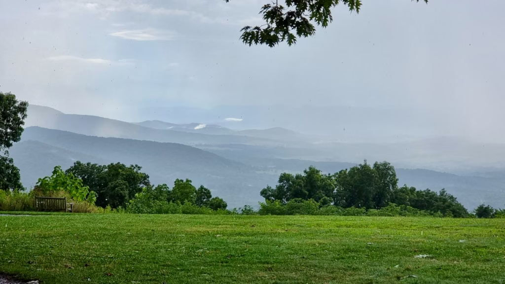 The lawn beside Dickey Ridge Visitor Center, looking west over the valley.
Researched, checked in November 2026: the visitor centre is open 9 am to 4:30 pm, Friday to Tuesday (closed Wednesday and Thursday), with an information desk, exhibits, a film, a park store and toilets. The 1.2-mile Fox Hollow Trail loop starts across the road, and the picnic area is open all year.
Signal Knob Overlook (mile 5.7)
A mile further on, Signal Knob Overlook gave me the widest view of the afternoon. Strips of low cloud were hanging over the forested hills below, and beams of sunlight were breaking through the clouds onto the valley. I spent a few minutes taking pictures from behind the low stone wall.
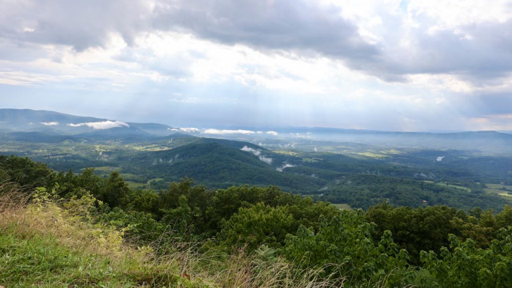 Low cloud clinging to the hills below Signal Knob Overlook.
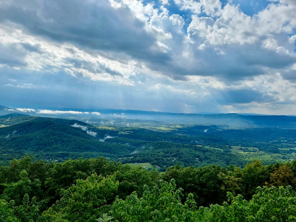 Sunbeams over the valley. The long ridge across it is the Massanutten.
The overlook faces west-northwest across the Shenandoah Valley to Massanutten Mountain. Signal Knob, the northern tip of that ridge, gives the overlook its name. During the American Civil War (1861 to 1865), Confederate soldiers used it as a lookout and signal post. Its best-known use was during the Battle of Cedar Creek, and Union troops took control of it in 1864.
A Short Walk on the Appalachian Trail at Elkwallow (mile 24)
By the time I reached the Elkwallow area, the road was wet and dotted with puddles. Here I picked a trail more or less at random: from the picnic area, a signpost pointed to the Jeremys Run Trail and the Appalachian Trail, and I followed it.
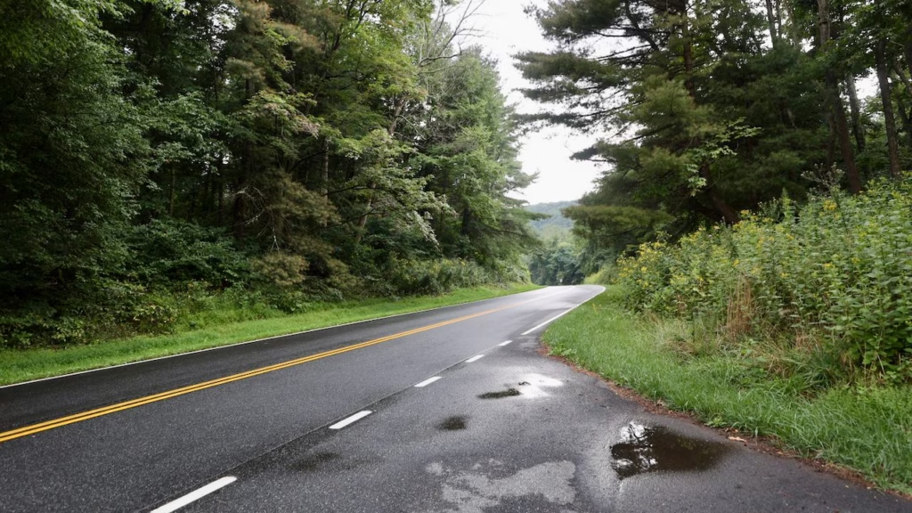 Puddles on Skyline Drive near Elkwallow, at a quarter past five.
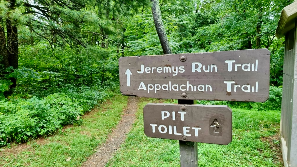 The signpost that chose my walk: Jeremys Run Trail and the Appalachian Trail, straight ahead.
It was a short out-and-back of about 40 minutes, from 5:17 to 5:58 pm, on a narrow dirt path through tall, straight trees, with ferns covering the slopes on either side.
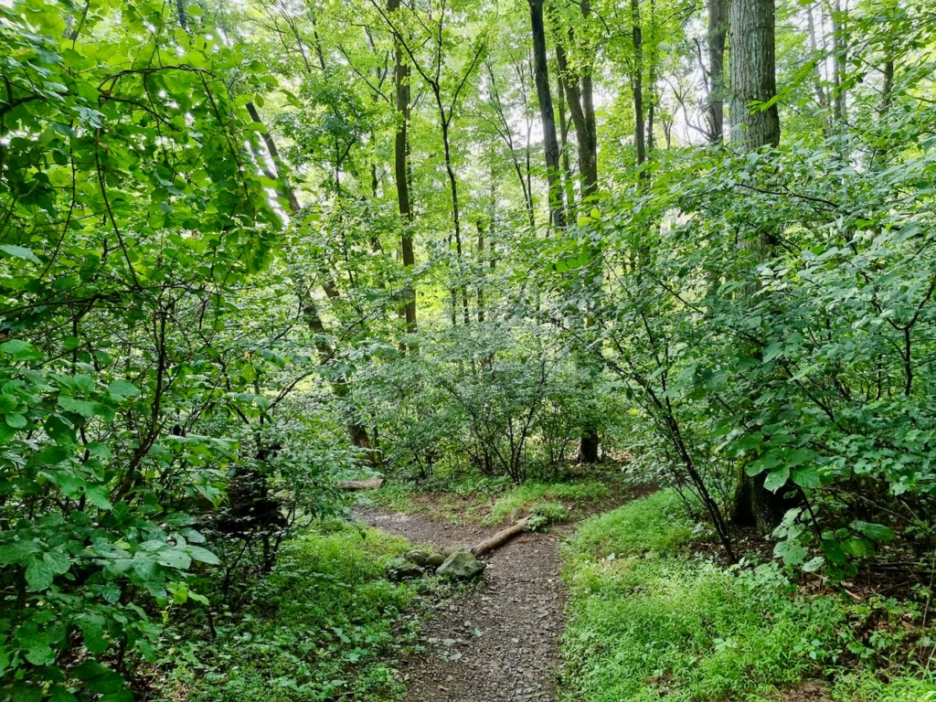 A few minutes from the picnic area: a narrow dirt path through thick green forest.
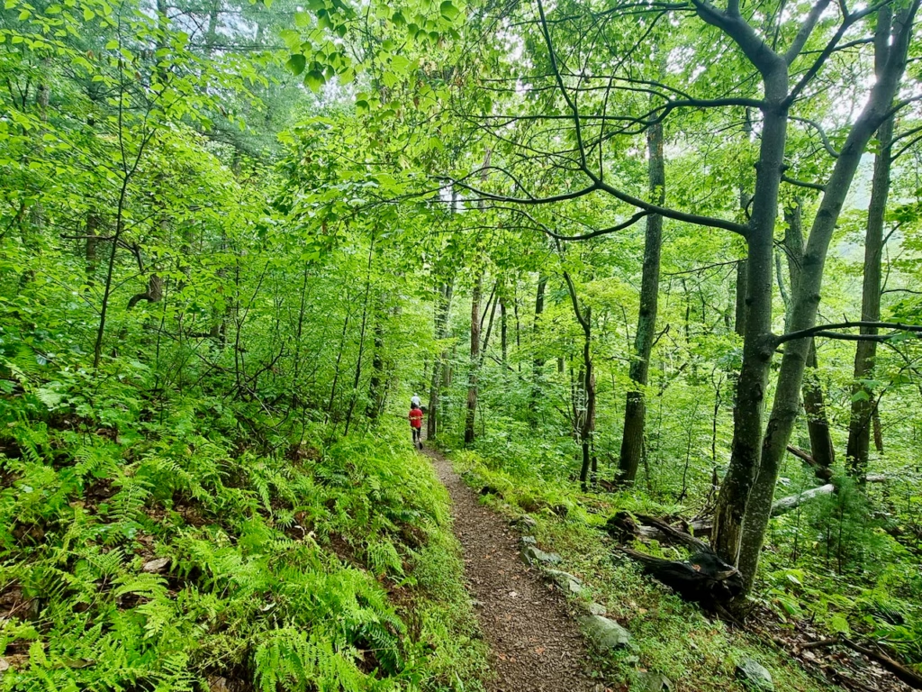 Ferns on both sides of the path, under a high canopy.
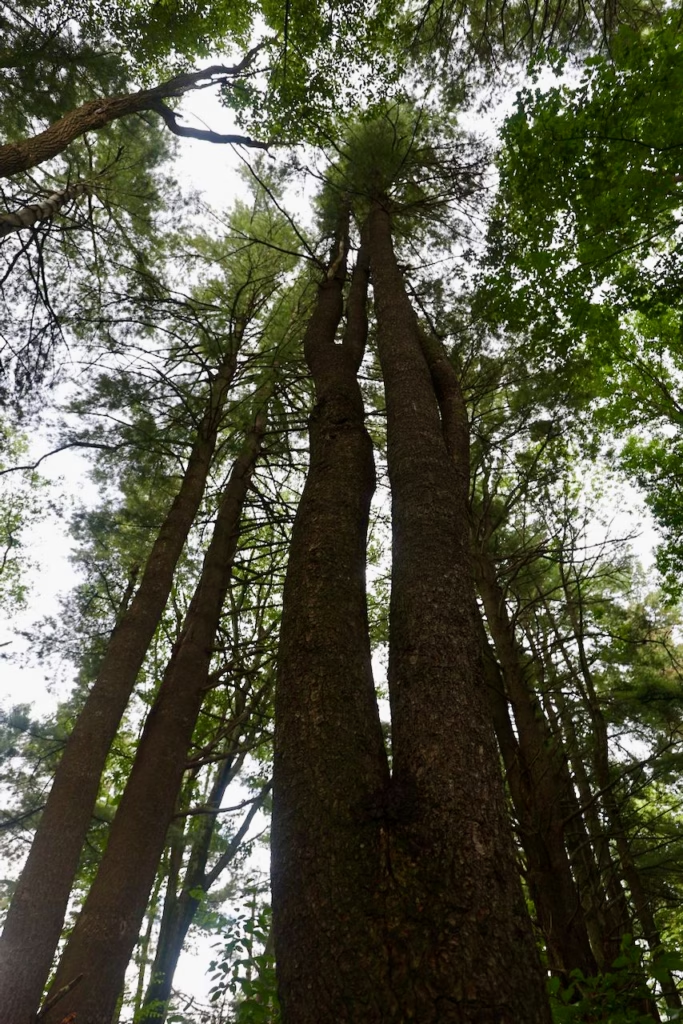 Look up. Tall, straight trunks rise into the canopy along the trail.
Researched, checked in November 2026: from the Elkwallow picnic area, a connecting trail of under 100 yards joins the white-blazed Appalachian Trail, and after a few hundred yards the blue-blazed Jeremys Run Trail branches off. It drops towards Jeremys Run, a stream in a quiet, wooded valley. The National Park Service lists a 6-mile circuit with Knob Mountain from Elkwallow, which it rates as moderately strenuous. Elkwallow Wayside, with food and supplies, is open from 29 April to 8 November in 2026.
Thornton Gap (mile 31.5)
Thornton Gap is the entrance on US 211, with Luray down the mountain to the west. I stopped briefly at about 6:20 pm, where information boards introduce the park, and carried on south through Marys Rock Tunnel, the only tunnel on the Drive.
A Deer on Skyline Drive
At 6:51 pm, a couple of minutes before my last stop, a deer was grazing on the grass right beside the road, and I took its picture through the windscreen. Deer, and sometimes black bears, cross the Drive.
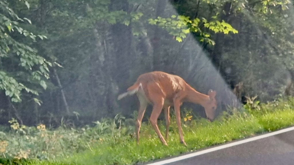 My only wildlife sighting, taken through the windscreen at 6:51 pm. Drive slowly at dusk.
Evening at Spitler Knoll Overlook (mile 48.1)
My last stop was Spitler Knoll Overlook, from 6:53 to 7:01 pm. It’s a long overlook that curves round a bend in the road behind a stone wall, with a dead tree standing out against the sky and a wide view west over the valley. The sun was low and the sky over the ridges was turning gold.
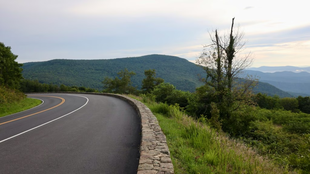 Spitler Knoll Overlook wraps around a bend in the road, so you get a wide view without leaving the car park.
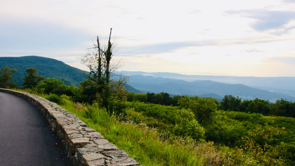 The dead tree at Spitler Knoll makes a natural frame for the valley.
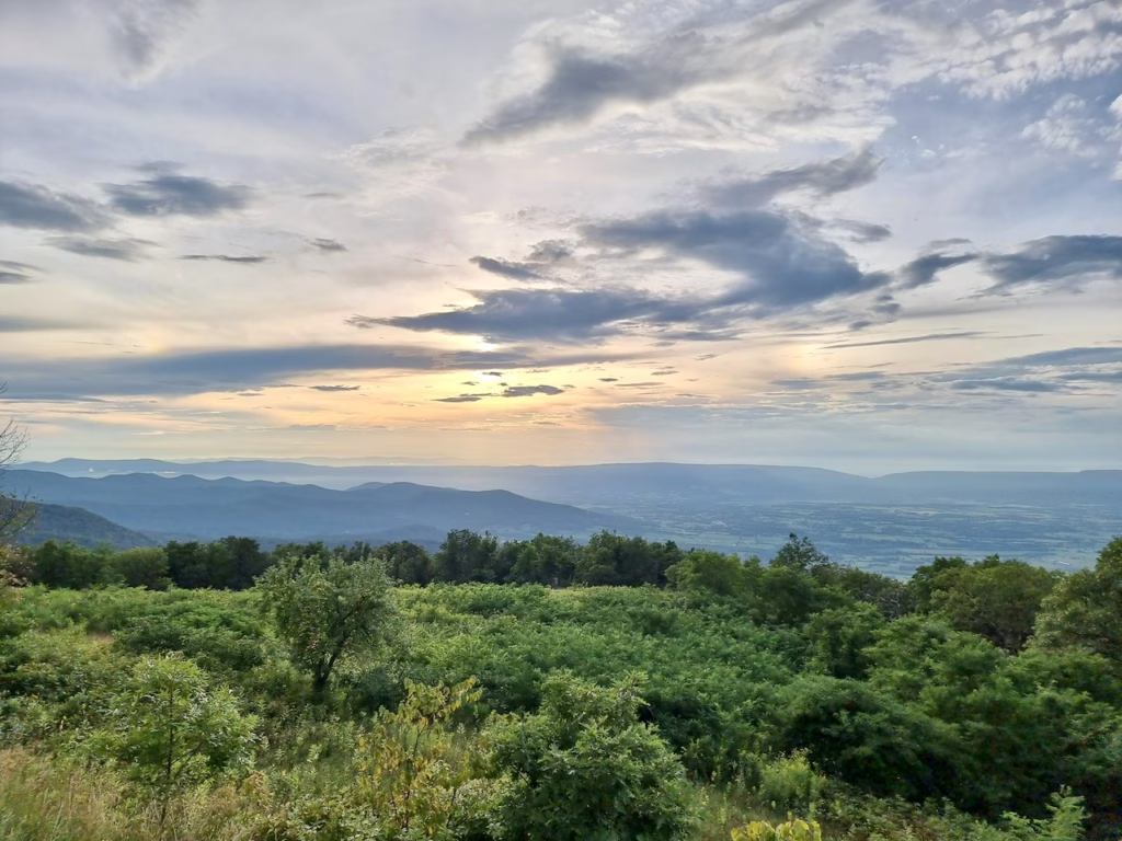 7 pm in late August. The light was turning gold, but sunset was still about three quarters of an hour away.
I left soon after 7 pm, so I didn’t stay for the sunset itself. In late August the sun sets a little before 8 pm, and the overlook faces west-northwest, so in summer it lines up well for sunset if you have time to stay on.
Researched, checked in November 2026: Spitler Knoll Overlook sits at 3,285 feet. It was once the site of Spitler Ranch, when livestock grazed on these mountain slopes. Big Meadows, with the park’s only gas station, a lodge and the Byrd Visitor Center, is about three miles further south.
How Long Do You Need for a Shenandoah Day Trip?
The National Park Service says Skyline Drive takes about three hours from end to end on a clear day, and that’s without stopping. With stops, one day isn’t enough to see all 105 miles properly, so on a Shenandoah National Park day trip, pick one section. Here’s how my afternoon compares with a full day:
Afternoon (what I did)
- Front Royal entrance to mile 48
- Two overlooks and a visitor centre
- One short walk in the forest
- About 3 hours, leaving before sunset
Full day
- Start at Thornton Gap in the morning
- Three or four short Central District walks, such as Stony Man and Dark Hollow Falls
- Lunch at Skyland or Big Meadows
- Stay at a west-facing overlook for sunset
On a Shenandoah day trip from Washington, DC, the Front Royal entrance and the North District are the easiest to reach. If you’re coming from Luray, start at Thornton Gap instead and head into the Central District.
The Best Places to Visit in Shenandoah National Park in One Day
Researched, checked in November 2026: I only drove the northern half of Skyline Drive, so apart from Spitler Knoll, the stops in this section come from the National Park Service’s trail information, not my own visit. Distances are round trips, and times are the park’s estimates.
If you want to make the most of one day, spend it in the Central District. Most of the park’s best-known summits, waterfalls and viewpoints sit in the 25 miles between Thornton Gap (mile 31.5) and Bearfence Mountain (mile 56.4), so you can see several of them without long drives in between. These are the stops I’d shortlist, in Skyline Drive order:
- Marys Rock (mile 33.5): a 2.9-mile hike from the Meadow Spring parking area to a rocky summit with wide views west over the Shenandoah Valley. It’s moderate and takes about 3 hours, so choose it only if you have time for one longer walk.
- Stony Man (mile 41.7): the best view for the least effort. A 1.6-mile loop, rated easiest, takes about an hour and leads to the park’s second-highest peak, looking over the valley to Massanutten Mountain. No dogs.
- Whiteoak Canyon (mile 42.6): a 4.6-mile hike down to the upper falls and back, taking about 3.5 hours, with a 1,040-foot climb on the return. On a single day, choose this or Dark Hollow Falls, not both.
- Hawksbill Summit (mile 46.5): the highest point in the park at 4,051 feet, with a stone viewing platform and an almost 360-degree view. From the Upper Hawksbill parking area it’s a 2.1-mile walk, rated easiest, of about 1.5 hours.
- Dark Hollow Falls (mile 50.7): the closest waterfall to Skyline Drive, about 70 feet high. The 1.4-mile trail is moderate and takes about 1 hour 15 minutes. It’s downhill all the way to the falls, so the hard part is the climb back up. No dogs.
- Big Meadows (mile 51): a wide, open meadow where deer often graze, with the Byrd Visitor Center, a lodge, food and the park’s only gas station.
- Bearfence Mountain (mile 56.4): a short rock scramble to a 360-degree view. The 1.4-mile loop is moderate and takes about an hour, but you climb over boulders using your hands, so skip it if you’re nervous of heights or the rock is wet. No dogs.
Two more are good to know about. Old Rag is the park’s most famous hike, but it starts outside Skyline Drive on the eastern edge of the park, and the 9.4-mile circuit is rated very strenuous and takes about 7.5 hours, plus the $2 day-use ticket. It’s a full day on its own. And if you’re driving as far as the South District, Blackrock Summit (mile 84.4) is a 1-mile, 45-minute circuit to a boulder field with wide views.
A One-Day Shenandoah Itinerary for First-Timers
Here’s a plan that fits the highlights into one day, starting at Thornton Gap. From Washington, DC, the park’s directions take you there via I-66, US 29 and US 211. Arrive early: the car parks at Dark Hollow Falls and Bearfence Mountain are small and fill quickly on busy days.
Thornton Gap, mile 31.5 (around 9 am) → Stony Man, mile 41.7 (1-hour walk) → lunch at Skyland, mile 41.7 → Hawksbill Summit from Upper Hawksbill, mile 46.5 (1.5 hours) → Dark Hollow Falls, mile 50.7 (1 hour 15 minutes) → Big Meadows, mile 51 → Bearfence Mountain, mile 56.4 (1 hour) → back north to a west-facing overlook, such as Spitler Knoll, mile 48.1, for sunset
Researched plan · about 33 miles of Skyline Drive · nearly 5 hours of walking · a full day
The suggested route: Thornton Gap to Stony Man, Hawksbill, Dark Hollow Falls, Big Meadows and Bearfence Mountain, then back north to Spitler Knoll Overlook for sunset.
If you only have time for one walk, make it Stony Man; if you want a waterfall, Dark Hollow Falls. If you enter at Front Royal instead, as I did, it takes about 1 hour 15 minutes of driving at 35 mph just to reach Stony Man, so leave earlier.
Luray Caverns and Shenandoah in One Day
I spent the early afternoon underground at Luray Caverns before driving into the park, and the two fit together easily: the caverns are about 10 miles, or 15 minutes, west of the Thornton Gap entrance. I left the caverns soon after 3 pm and drove north to the Front Royal entrance instead, and still had three hours on the Drive before 7 pm.
For a Luray and Shenandoah day: do the caverns first, around midday, since they look the same at any hour, and keep the Drive for the late afternoon and evening light, as I did.
Practical Tips for Skyline Drive
There’s only one gas station inside the park, at Big Meadows Wayside, which also has a café and shop. It’s open from late March to late November. Fill up in Front Royal or Luray before you go in.
Elkwallow Wayside, Big Meadows Wayside and Skyland sell food from spring to autumn. Picnic areas, including Dickey Ridge and Elkwallow, are open all year.
The entrance stations take cards and phone payments only. You can also buy your pass in advance on recreation.gov.
Deer are common beside the road, and black bears live in the park. Keep to 35 mph, especially around dusk, and never feed animals.
The ridge is cooler than the valley, and showers come and go. Skyline Drive is generally open 24 hours, but it can close at any time in bad weather.
Summer and autumn weekends get busy. The park suggests entering at Swift Run Gap or Rockfish Gap to avoid queues at Front Royal and Thornton Gap, and moving on if a trailhead car park is full.
Marys Rock Tunnel, just south of Thornton Gap, has a clearance of 12 feet 8 inches. If you’re driving a recreational vehicle (RV) or towing, check your height and use low gear on the descents.
Most overlooks have accessible parking, so you can take in the view from the car. The Limberlost Trail (mile 43) is a fully accessible 1.3-mile loop on a crushed-stone path.
How to Get to Shenandoah National Park
By car, including from Washington, DC
Driving is the only practical way to see Skyline Drive, since there’s no public transport through the park. The Front Royal entrance is about 70 miles from Washington, DC, or roughly 1.5 hours on I-66 without traffic. I came from Hopewell, near Richmond, via Luray. If you’re flying in, renting a car is the simplest option, and it lets you add Luray Caverns on the same day.
Cars can only enter at the four entrance stations:
- Front Royal (mile 0): from US 340 in Front Royal; the closest to Washington, DC.
- Thornton Gap (mile 31.5): on US 211, between Luray and Sperryville; the closest to Luray Caverns.
- Swift Run Gap (mile 65.5): on US 33, near Elkton.
- Rockfish Gap (mile 104.6): near I-64 and Waynesboro, where Skyline Drive meets the Blue Ridge Parkway.
Driving yourself
Compare car rental prices in Washington, DC or Richmond
Check prices
With a tour
If you don’t have a car, a day tour from Washington, DC is the realistic way to go. If you’re driving yourself, an audio tour fills in the stories behind the overlooks as you go.
Shenandoah and Skyline Drive tours
I drove myself, so I haven’t taken any of these. Check on each listing whether the park entrance fee is included.
Where to Stay for a Shenandoah Day Trip
I didn’t stay in the park: I drove back to my family’s home in Hopewell that night. For an early start, Front Royal (for the North Entrance) or Luray (for Thornton Gap) are the closest towns. There’s also lodging inside the park at Skyland and Big Meadows, which I didn’t use.
Hotels near Shenandoah National Park
Is a Shenandoah National Park Day Trip Worth It?
Yes, even a short one. Arriving just before 4 pm still gave me three good hours: a wide valley view with low cloud below me, a walk on the Appalachian Trail, a deer by the road and golden evening light over the Blue Ridge. There are trade-offs. Much of the Drive runs through forest, so the views come at the overlooks rather than all the way along. It’s slow at 35 mph, and one day only covers part of it. If you’re short of time, pick a section, stop often, and stay for sunset, which I didn’t.
For more of my US trips, see my USA travel guides, including how I visited the Grand Canyon without a car on the same trip.
Frequently Asked Questions
Can you do Shenandoah National Park in one day?
Yes, but not all of it. Driving the whole of Skyline Drive takes about three hours without stops, so for a day trip pick a section. I covered mile 0 to mile 48 in an afternoon, with two overlooks, a visitor centre and a short walk.
What are the must-see places in Shenandoah National Park?
For a first visit, focus on the Central District: Stony Man and Hawksbill Summit for views, Dark Hollow Falls for a waterfall, Big Meadows for deer, and Bearfence Mountain if you’re happy to scramble over rocks. All are between miles 41 and 57 of Skyline Drive.
How much does it cost to enter Shenandoah National Park in 2026?
A private vehicle pays $30 for a 7-day pass, a motorcycle $25, and visitors on foot or by bike $15 per person aged 16 and over. The park is cashless, so pay by card or buy your pass on recreation.gov.
Do international visitors pay more at Shenandoah?
No. The new $100 nonresident fee applies only at 11 of the busiest national parks, and Shenandoah isn’t one of them. Nonresidents pay $250 for the America the Beautiful annual pass, against $80 for US residents.
Is the America the Beautiful pass valid at Shenandoah?
Yes. It covers the entrance fee for you and the people in your car. I used mine in 2021.
How long does it take to drive Skyline Drive?
About three hours from end to end on a clear day, without stops, according to the National Park Service. The road is 105 miles long and the speed limit is 35 mph.
Which entrance is best for a day trip from Washington, DC?
The Front Royal entrance at the northern end is closest, about 70 miles from DC, or roughly 1.5 hours without traffic. Thornton Gap is closer if you’re also visiting Luray Caverns.
What are the best overlooks on Skyline Drive for a short visit?
Of the ones I stopped at, Signal Knob Overlook near the northern end gave the broadest valley view, and Spitler Knoll Overlook, further south, caught the evening light. Both face west-northwest over the Shenandoah Valley, which suits afternoon and evening light.
Is there gas in Shenandoah National Park?
Only at Big Meadows Wayside, which is open from late March to late November in 2026. Fill up before you enter.
Will I see wildlife on Skyline Drive?
Possibly. I saw a deer grazing beside the road at 6:51 pm. Deer are common, and black bears live in the park too, so drive slowly, especially around dusk.
Are dogs allowed in Shenandoah National Park?
Yes, on most trails, on a leash no longer than 6 feet. They aren’t allowed on a few popular trails, including Fox Hollow, Stony Man, Dark Hollow Falls, Bearfence Mountain and Old Rag.
Is Skyline Drive open at night?
Skyline Drive is generally open 24 hours a day, but it can close at any time in bad weather, so check conditions before you go.
Read next Luray Caverns: My Self-Guided Visit, Tickets and Tips Where I spent the early afternoon before driving into the park.
→
Please visit:
Our Sponsor
Related Posts

PolyU Unveils Large Language Model-based Tourist Satisfaction Index, Providing Comprehensive Analysis to Enhance Hong Kong Tourism Service Quality
As tourism, one of the major pillars of the Hong…

Your browser is not supported
Your browser is not supported | freep.comfreep.com wants to ensure…

A month of purpose: MGallery Collection stands against Breast Cancer this October
For its seventh year, MGallery Collection, a refined portfolio of…