Most guides point you up Mt Wellington for sunset. That is fair advice. But the mountain is a long drive, the weather turns without warning, and if you have only a couple of evenings in Hobart you might want something closer, quieter, and easier to reach.
That is where the eastern shore comes in.
I spent four nights in Hobart in January and gave myself two evenings on this side of the Derwent. One at Rosny Hill Lookout. The next in Bellerive, walking from the yacht club through the neighbourhood to Kangaroo Bluff Battery. Between them they cover the two moods most travellers actually want: the quick postcard shot, and the slow evening stroll with somewhere to end up.
Neither spot gets much coverage from personal travel blogs. The search results are mostly aggregators and one wine-tour company. So this is the on-the-ground version, weather and all.
The quick answer
If you have one evening and want the classic view of Hobart at sunset, go to Rosny Hill Lookout. Fifteen minutes from the CBD by car, panoramic sweep of the Tasman Bridge, the city, and Mt Wellington. You can be up and back inside an hour.
If you have longer and want the sunset to be part of an actual walk with beach, history, and a coffee at the end, go to Bellerive. Start at the yacht club, walk past Blundstone Arena and along the beach, then climb to Kangaroo Bluff Battery for the closing view. Allow two to three hours.
Both spots face west across the Derwent. The sun sets behind kunanyi/Mt Wellington from your view, giving you the silhouette when the sky cooperates.
Rosny Hill Lookout: the fastest sunset in Hobart
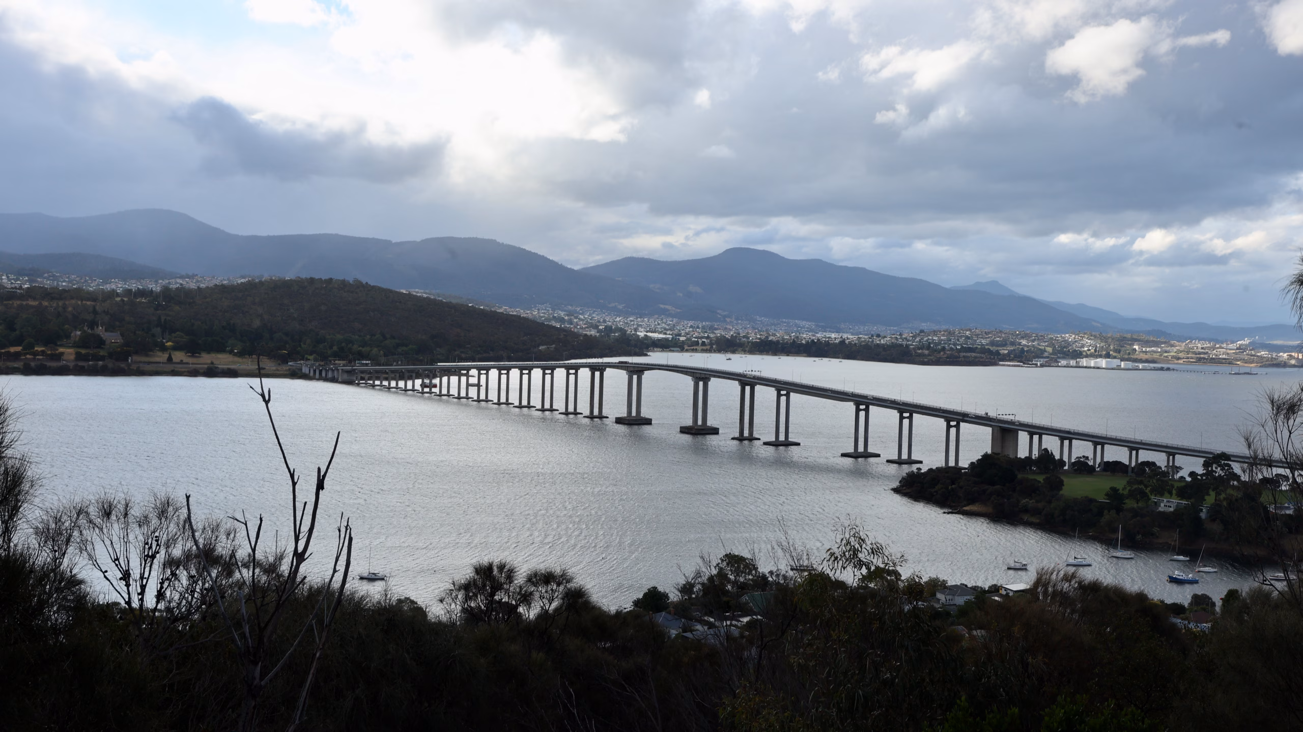
The lookout sits at the top of Rosny Hill on a small peninsula jutting into the Derwent, about six kilometres from the CBD. You cross the Tasman Bridge, take the East Derwent Highway, then climb Leura Street. Free parking at the top, a viewing platform, and interpretive signs that name what you are looking at.
What you see from the platform is the whole shape of Hobart. The Tasman Bridge sweeps across the middle of the frame, its concrete pylons receding in perspective. Behind the bridge the CBD spreads along the western shore. Above that, Mt Wellington fills the western sky. On a clear day you can pick out the Royal Tasmanian Botanical Gardens, Sullivans Cove, and the port. The sun sets somewhere over the mountain, so what you are watching is not the sun disc itself but the way it lights the sky above kunanyi and the ships in the harbour below.
 Storm cloud over Mt Wellington from Rosny Hill Lookout
I arrived about half an hour before sunset. Saturday in January. Two other cars in the carpark. Quiet in a way that surprised me for a place reviews describe as popular.
 Hobart CBD from Rosny Hill Lookout, light breaking on the Derwent
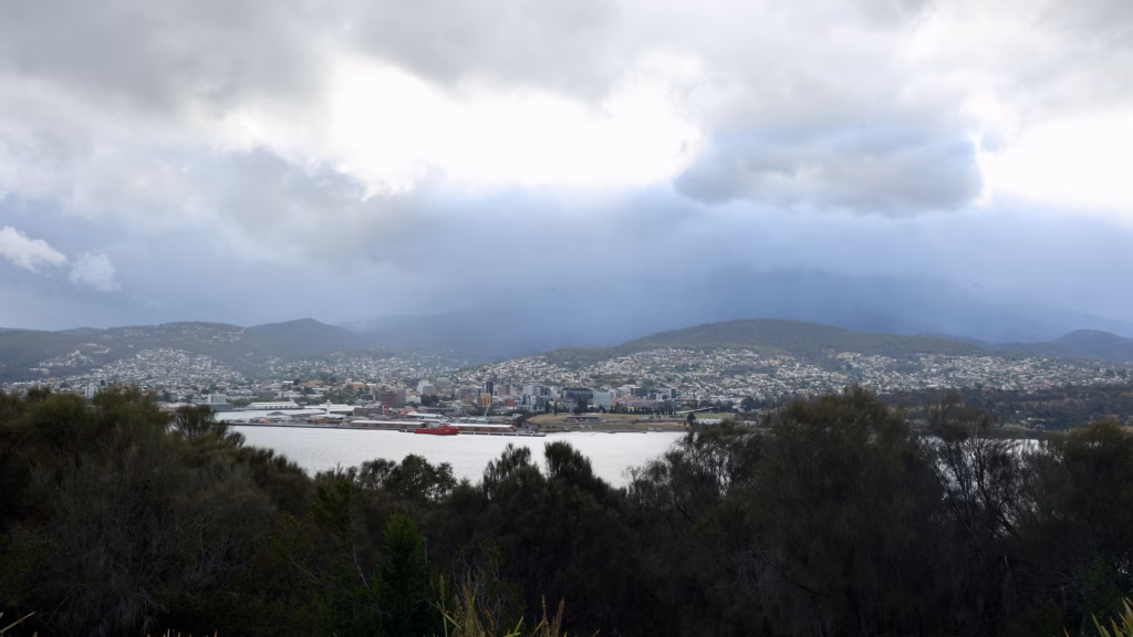
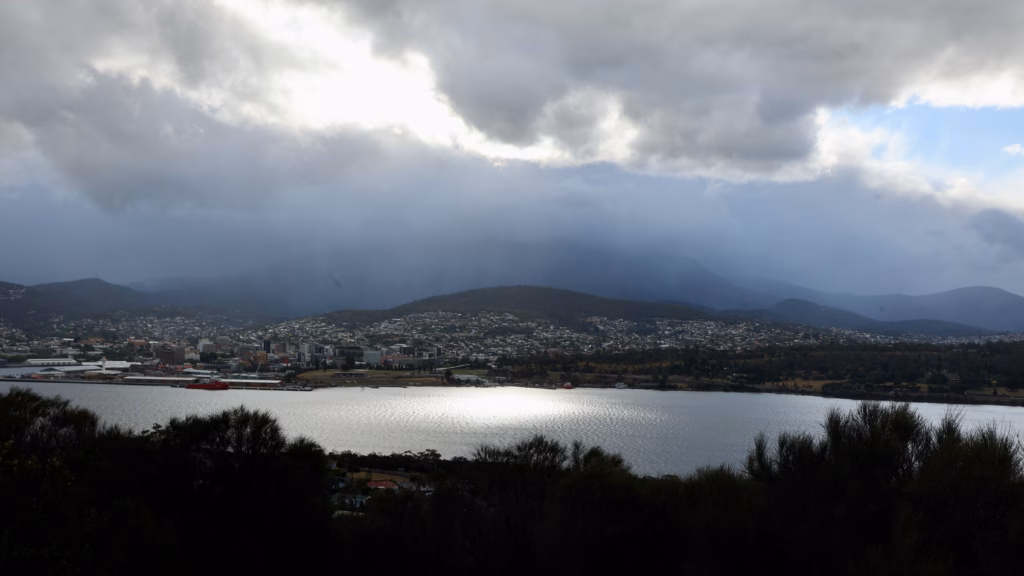
The weather did not play along. Cloud sat on top of Mt Wellington the whole evening, thick and grey. The postcard version of a Rosny Hill sunset it was not. What I got instead was moody. Storm cloud pressing down on kunanyi, the city and the port stretched out below under diffuse grey light, the Tasman Bridge holding its shape against the dark backdrop.
Then the light broke. A gap opened somewhere out to the west and a silver sheet dropped onto the Derwent, picking out a red-hulled ship at Macquarie Wharf, home port of Australia’s Antarctic icebreaker RSV Nuyina. It lasted maybe two minutes and then the cloud closed again. That is Tasmania in a single evening.
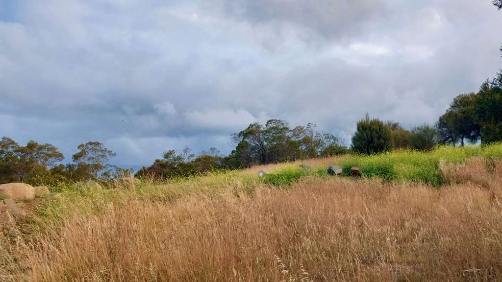
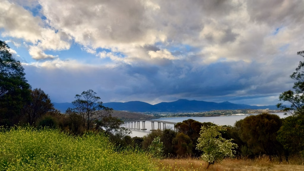 Tasman Bridge and the Derwent River viewed from the Rosny Hill Circuit Track through wild fennel and summer grass, on the walk down from Rosny Hill Lookout in Hobart.
There is a walking track that drops off the back of the lookout, linking with the Rosny Circuit Track around Kangaroo Bay. I started walking it, curious. The path drops away from the platform, and for a moment the view opens differently. Wild fennel and dry summer grass in the foreground, the bridge still visible through the eucalypts, warmer cloud undersides where the sun was trying to get through.
 The Rosny Circuit Track drops off the back of the lookout
But the vegetation closes in fast. Coastal scrub, gum trees, hip-high grass filling the corridor. Whatever the platform sees, the track loses. I turned back after ten minutes.
Rosny Hill is for the quick view. Bellerive is for spending time.
The last thing worth flagging is the after-dark question. Blue hour at Rosny Hill would be the strong photographer’s move. City lights coming on across the water, the bridge lit up, the sky going indigo. I did not stay. It felt very quiet up there, no other visitors after the two cars I saw at arrival, no lighting once dusk set in. Nothing happened. It was just a call I made in the moment. If you go, factor this in.
Getting to Rosny Hill by public transport is doable but not fun.
The nearest Metro bus stop is on Bastick Street via route 676, or you can get off at Rosny Park interchange from several routes and walk up Leura Street. Either way it is a 10 to 15 minute uphill walk through suburban streets. In daylight it is fine. After sunset with limited street lighting, less so. Hiring a car for a day makes the whole eastern shore considerably easier. I use DiscoverCars to compare rates in Hobart.
Bellerive: the sunset walk with a battery at the end
If you have a spare afternoon that rolls into evening, Bellerive is the better plan. It is a proper suburb rather than a lookout, and you can build the sunset into a real walk with a start, a middle, and an end.
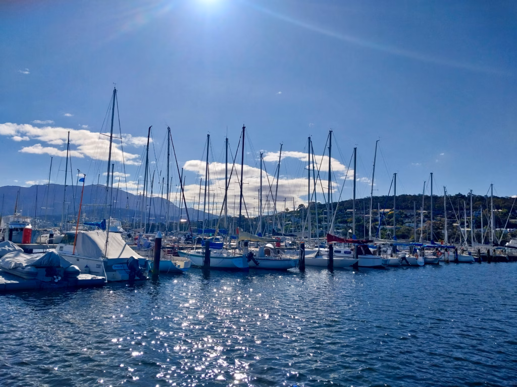 Bellerive Yacht Club marina on Kangaroo Bay with sailing boats and Mt Wellington backdrop, one of the underrated views on Hobart’s eastern shore.
I did it the next day. Bus and walk combination from the CBD, about forty-five minutes each way. Started at the yacht club around five in the afternoon.
The marina is the first surprise. Bellerive Yacht Club sits on Kangaroo Bay with a couple of hundred boats moored across the water. From the boardwalk you get yacht masts in the foreground and kunanyi filling the western sky behind them. It is a frame you see on postcards of Sydney or Auckland. Nobody has told you it exists in Hobart.
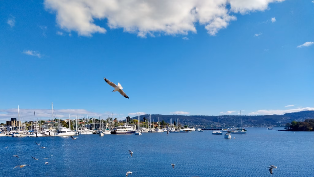 Seagulls at Bellerive Yacht Club marina, Hobart, on a summer afternoon walk toward Kangaroo Bluff Battery.
Seagulls will follow you. Not the calm variety. The kind that consider your sandwich negotiable.
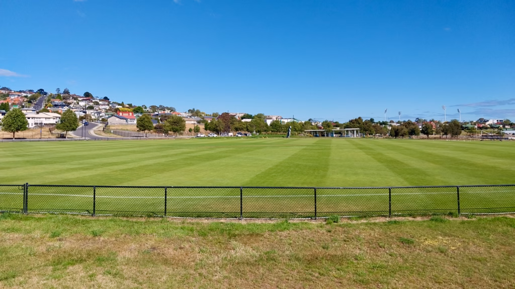 A local cricket ground on the walk to Blundstone Arena
From the yacht club you walk east, keeping the water on your left. On the way you pass a smaller community cricket ground, its outfield mown into fresh stripes, with the main stadium’s floodlights already visible on the horizon.
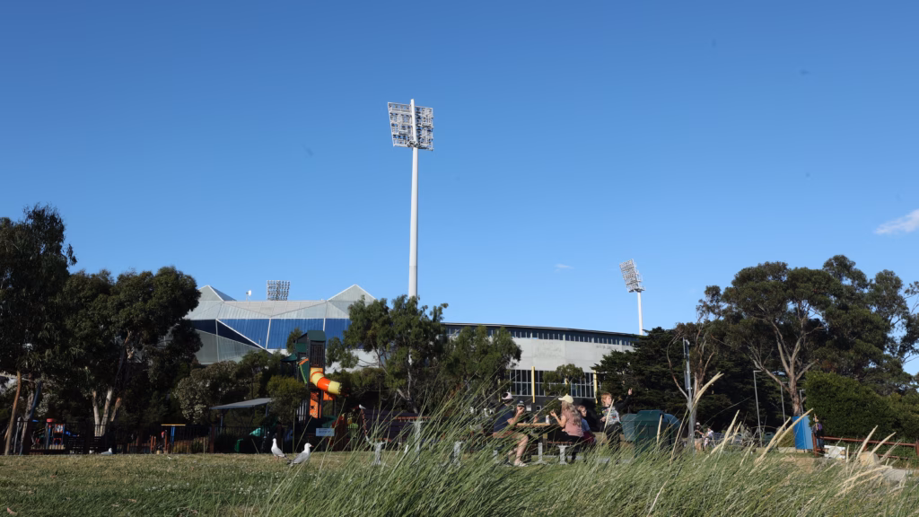 Bellerive Beach Park with Blundstone Arena (Ninja Stadium) in the background, Hobart’s home of international cricket, on the walk from the yacht club to Kangaroo Bluff Battery.
Within a few minutes you are outside Blundstone Arena. This is Bellerive Oval, the only ground in Tasmania that hosts international cricket, opened in 1914 and now officially called Ninja Stadium under a sponsorship deal signed in October 2024. Most locals still say Blundstone Arena from the thirteen years the boot company held the naming rights. The building itself is worth a look even from outside. Angular metal-and-glass roof, two tall floodlight pylons that anchor the Bellerive skyline.
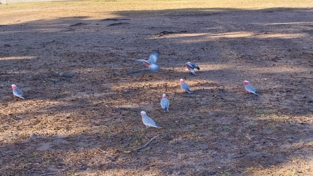 Pink-and-grey galahs at Bellerive, Hobart, on the walk between Blundstone Arena and Bellerive Beach.
Around the arena is Bellerive Beach Park, which is where the character of the place actually lives. Playgrounds, families, picnic tables, and a small flock of galahs foraging on the grass when I walked past. The pink-and-grey ones. If you have never seen them in the wild before, this is one of the everyday things that makes Australia feel very different from anywhere else.
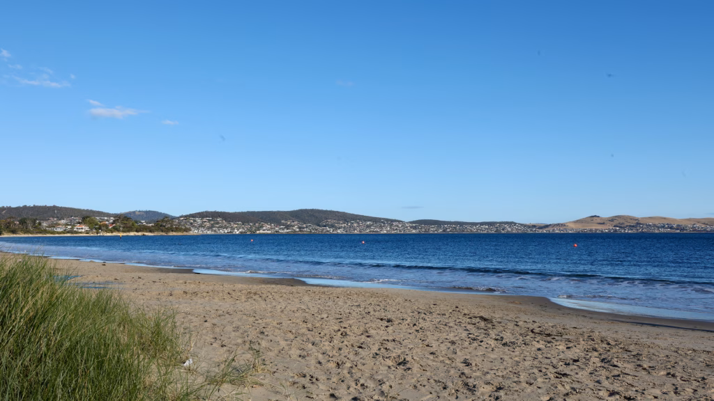
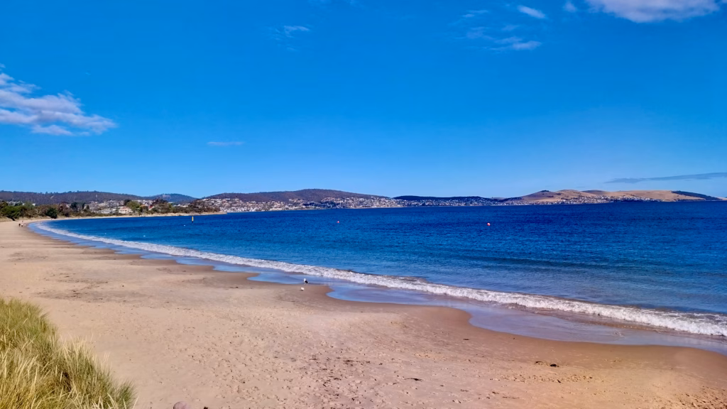 Bellerive Beach in the late afternoon with the Derwent River curving south
Push past the arena and you are on Bellerive Beach itself. A long crescent of sand facing south across the mouth of the Derwent. You can see the dry summer hills of South Arm across the water, houses climbing the slopes of Rokeby to the south-east. It is the kind of quiet suburban beach where a handful of locals walk their dogs at any hour of the day.
 Marram grass anchors the low dunes at the back of Bellerive Beach
The beach itself is more textured than it looks from a wide angle. Marram grass anchors the low dunes at the back, the tide-line changes character over the length of the crescent, and the water shifts colour with the cloud. Worth walking rather than just looking at.
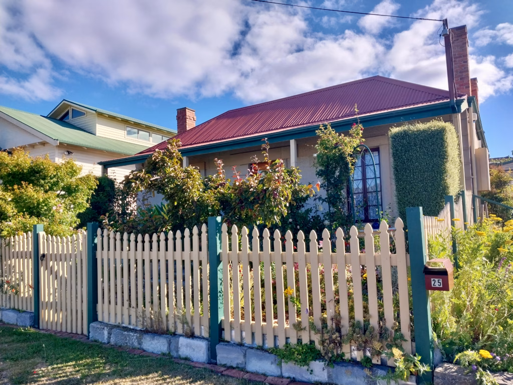 A heritage cottage in the Bellerive backstreets on the walk to Kangaroo Bluff
Walk along the beach and you can climb up to the neighbourhood streets that back onto it. This bit is not on any itinerary. It is just Bellerive being Bellerive. Weatherboard cottages painted in soft colours. Deep cottage gardens full of yarrow and roses and vegetables gone to seed. Old picket fences painted teal and cream. Front verandahs with baskets of geraniums. Everywhere you look, somebody has spent time on their patch.
 Quiet residential street in Bellerive, Hobart, on the walk between the beach and Kangaroo Bluff Battery, showing the everyday character of this eastern shore suburb.
The streets themselves are quiet, sloping, and residential in a way you rarely see in tourist neighbourhoods. Cars parked at the kerb, powerlines overhead, the occasional resident wheeling a bin. It is the kind of place you would walk through slowly, taking in the small things.
Walking through it as the light started to warm was the best part of the whole afternoon.
Kangaroo Bluff Battery: the sunset payoff
At the eastern end of Bellerive Beach, the coast rises up. This is Kangaroo Bluff. On top of it sits a small Victorian-era coastal fort that most visitors to Hobart have never heard of.
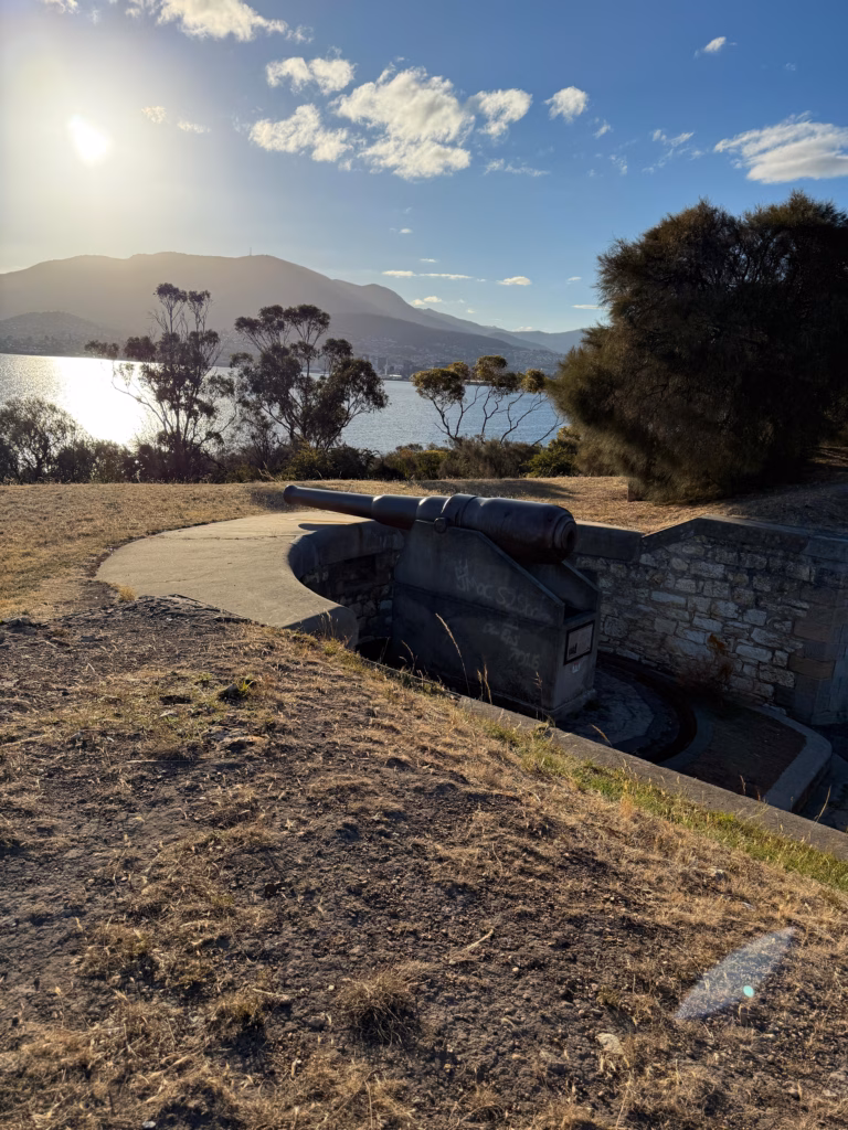 One of the two thirteen-tonne cannons at Kangaroo Bluff Battery, framing the sunset over Mt Wellington
The battery was built between 1880 and 1884, prompted by fears of Russian warships appearing in the Derwent in 1873. It was the third of Hobart’s three coastal defences, backing up the Queens Battery at the Domain and the battery on Battery Point across the water. Two thirteen-tonne cannons still sit on their original stone emplacements, aimed out over the Derwent at ships that never came. The fort saw no combat in its operational life. There is a line in the local history literature about it: “no shots were fired in anger.”
Below ground the fort has stone passageways with speaking tubes that were once used to communicate between gun platforms. You can walk through some of them. Free entry, no gate, no ticket, no ranger. It is just there.
Kangaroo Bluff Battery quick facts
- Address: 20 Gunning Street, Bellerive
- Cost: Free
- Facilities: None (no toilets, no bins, no shop)
- Best time for sunset: 30 to 45 minutes before official sunset
- Managed by: Parks and Wildlife Service Tasmania
The view is what you came for. From the grass on top of the bluff you look west across the Derwent to Mt Wellington. At sunset the mountain silhouettes against the sky and the water below turns silver. If you frame the shot to include one of the cannons in the foreground, you get the picture nobody has.
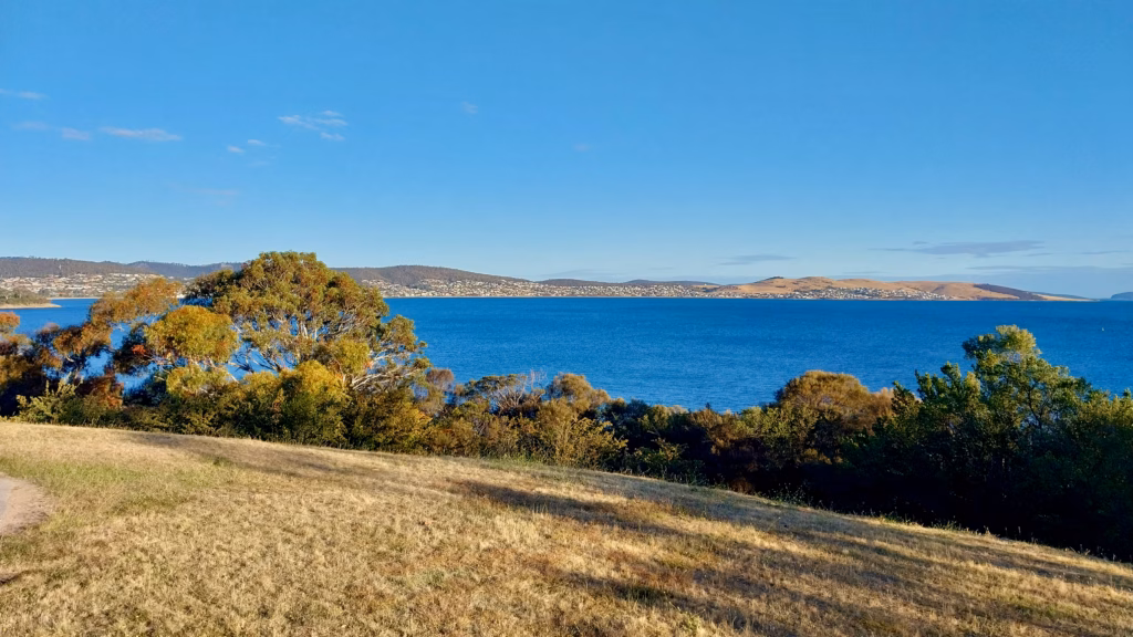 The view from Kangaroo Bluff Battery across the Derwent
Give yourself thirty minutes at the fort. Time to walk the perimeter, look at the interpretive signs, sit with the view. There is graffiti on one of the emplacements, which is a shame, but it does not spoil the place.
Honourable mentions inside Hobart
Mt Wellington is the obvious one and it deserves its own visit. If your weather is holding and you have a car or the shuttle bus, the pinnacle at sunset gives you a view that nothing else in Australia matches. It is also cold and windy and utterly weather-dependent. Deep dive here: Mt Wellington from Hobart, the complete visitor guide.
Battery Point on the western shore is the walkable option if you are staying in the CBD and cannot be bothered crossing the bridge. Princes Park sits above Sullivans Cove and gives you a westward view over the harbour. Combined with Salamanca and a wander through the heritage streets, it makes a good pre-dinner circuit.
Bruny Island is the day trip option. If you are going there anyway, the Neck Lookout at sunset is one of Tasmania’s better-known frames. Full breakdown in the Bruny Island day trip guide.
Sunset times in Hobart by season
Hobart’s latitude gives you long summer evenings and very short winter ones. Rough month-by-month sunset window:
| Month | Approximate sunset |
|---|---|
| January | 8:45 to 8:55 pm |
| February | 8:00 to 8:40 pm |
| March | 7:00 to 7:55 pm |
| April | 5:35 to 6:55 pm (DST ends early April) |
| May | 5:00 to 5:30 pm |
| June | 4:43 pm at earliest |
| July | 4:45 to 5:15 pm |
| August | 5:15 to 5:55 pm |
| September | 6:00 to 6:35 pm |
| October | 6:35 to 7:35 pm (DST starts early October) |
| November | 7:35 to 8:20 pm |
| December | 8:20 to 8:55 pm |
Always check the actual time for the day you are going. The mountain adds ten to fifteen minutes to the effective sunset when the sun goes down behind kunanyi from your position. Arrive at least thirty minutes before official sunset if you want the sky, and forty-five minutes if you want time to compose a photograph.
Photographer’s note
Both Rosny Hill and Kangaroo Bluff face west or south-west across water. Bring a tripod for blue hour and long-exposure water shots. Wind at Rosny Hill is worth taking seriously. Every review flags it. Bring a warm layer even in January. Bellerive Beach is more sheltered but exposed to any southerly.
Getting around
Mt Wellington is the obvious one and it deserves its own visit. If your weather is holding and you have a car or the shuttle bus, the pinnacle at sunset gives you a view that nothing else in Australia matches. It is also cold and windy and utterly weather-dependent. Deep dive here: Mt Wellington from Hobart, the complete visitor guide.
Battery Point on the western shore is the walkable option if you are staying in the CBD and cannot be bothered crossing the bridge. Princes Park sits above Sullivans Cove and gives you a westward view over the harbour. Combined with Salamanca and a wander through the heritage streets, it makes a good pre-dinner circuit.
Bruny Island is the day trip option. If you are going there anyway, the Neck Lookout at sunset is one of Tasmania’s better-known frames. Full breakdown in the Bruny Island day trip guide.
Where to eat around Bellerive
There is a small cluster of cafes and restaurants around Bellerive Quay worth knowing about, especially if you have walked from the yacht club and want to end the evening properly.
Abundance on the Quay is the local favourite for coffee and cafe-style food, right on the water with mediterranean-style platters and Sunday afternoon live music sessions in summer. Good for a stop before the sunset walk begins.
The Fish Bar is on Bellerive Beach itself, a floating restaurant tucked into the marina. Fish and chips, coffee, ice creams, and drinks. Works as a post-sunset dinner without leaving the water.
Bellerive Village around the Quay has a broader spread of Indian, Asian, and Italian places if you want alternatives.
Where to stay for eastern shore access
If you are chasing Bellerive sunsets on more than one evening, staying in the CBD works for one crossing but eats into your time. I stayed at Nightcap at Carlyle Hotel, which sits close to the bridge on the eastern side and puts you within a short drive of Rosny Hill and Bellerive both. Not the fanciest place in Hobart, but the location is unbeatable for what I was doing.
FAQ
Where is the best place to watch sunset in Hobart?
For the fastest, most iconic view: Rosny Hill Lookout on the eastern shore, panoramic sweep of the Tasman Bridge and CBD with Mt Wellington behind. For a longer sunset walk with variety: Bellerive, ending at Kangaroo Bluff Battery. For the highest and most dramatic option: kunanyi/Mt Wellington summit.
What time is sunset in Hobart?
It varies dramatically by season. Summer sunsets happen between 8:45 and 8:55 pm. Winter sunsets can be as early as 4:43 pm in mid-June. Always check the day-of time before you head out.
Is Rosny Hill Lookout free?
Yes. Free parking, free access to the platform, no gates or tickets. It is a public reserve.
Can you get to Rosny Hill by public transport?
Yes, but the last stretch is an uphill walk. Metro Tasmania buses stop on Bastick Street via route 676, or at Rosny Park interchange via several routes. From either, walk 10 to 15 minutes up Leura Street to the lookout. Doable in daylight, less pleasant after dark.
What is Kangaroo Bluff Battery?
A Victorian-era coastal fort in Bellerive, built between 1880 and 1884 in response to fears of Russian naval attack. Two thirteen-tonne cannons remain on their original emplacements. Free public access, no facilities. Sunset views west across the Derwent to Mt Wellington.
How long does the Bellerive sunset walk take?
Allow two to three hours from the yacht club to Kangaroo Bluff Battery, including time at each stop. If you also want dinner at Bellerive Quay after, add another hour.
Is Bellerive Beach safe for swimming?
It is a sheltered beach with generally calm water. Swim between the flags where and when they are flying. Water temperatures are cold outside summer.
Final thoughts
Rosny Hill is the shot. Bellerive is the story. If Hobart’s weather cooperates, either delivers. If it does not, both still give you something to work with. Between them, the sunset options on Hobart’s eastern shore are considerably better than the search results suggest.
Next up in the Hobart series: the Salamanca to Battery Point walk, and a three-day itinerary that pulls all of this together. If you are heading north after Hobart, the Launceston things to do guide covers your next stop.
Please visit:
Our Sponsor
Related Posts
Disney Springs Hotels Are Offering A HUGE Discount…But There’s A Catch
Are you planning a trip to Disney World this summer?…

Hunter Conference Takeaways: Survive 2025
The 36th Hunter Hotel Investment Conference took place this week…
Luxury travel news from around the world (February 2025)
From opulent trains crossing golden deserts to ultra-exclusive island retreats,…